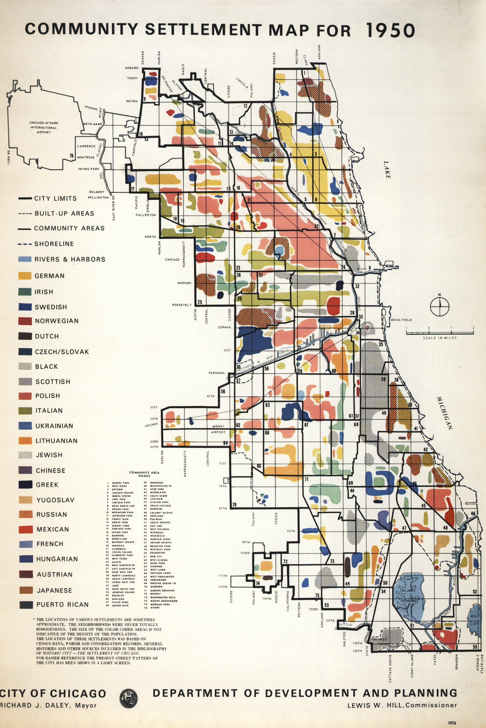
Community Settlement Map for 1950, City of Chicago, Department of Development and Planning, 1976. Accessed from the Chicago History Museum, ICHi-051194.
Paper Title
Highways to Walkways: Urban Mobility and Regeneration Challenges in Chicago
Abstract
The evolution of urban mobility has played a pivotal role in shaping the physical and socioeconomic landscapes of the United States (US). From the automobile-centric paradigms of the twentieth century to the current discourse on sustainability and equity, transportation infrastructure has both driven and reflected broader urban change. This paper selects Chicago as the research object, investigates this transformation through two contrasting models: the disruptive legacy of Chicago’s mid-twentieth-century highway system and the reparative potential of twenty-first-century urban regeneration projects.
The interstate highway system profoundly shaped the city’s growth in Chicago. However, it also contributed to urban sprawl and socioeconomic disparities. The system’s construction historically disrupted predominantly minority and low-income neighborhoods, exacerbating displacement and limiting access to opportunities. In contrast, contemporary adaptive reuse projects—exemplified by pedestrian-oriented rail-to-trail conversions—aim to mend urban divisions by repurposing abandoned infrastructure for walkability, green space, and public accessibility. These interventions promise ecological benefits, enhanced accessibility, and community engagement. However, new challenges emerge in such projects, leaving the issues of green gentrification, community reconnection, and equal access that need to be discussed.
The paper employs archival maps, historical photographs, and analysis diagrams to trace the impacts of these mobility shifts. The first part will examine the impact of the Interstate-90 highway on both the North and South sides of Chicago. The second part will discuss how the reuse of abandoned railways addresses concerns brought up by the highway system. Findings suggest that a sustainable regeneration hinges on synthesizing functional innovation with community-specific adaptation. Yet, challenges of gentrification and equality issues remain.
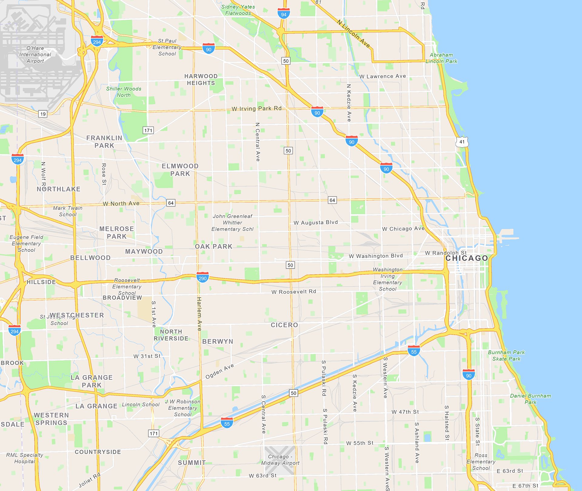
Excerpt map of the Chicago Highway System. © ArchGIS, City of Chicago, 2025
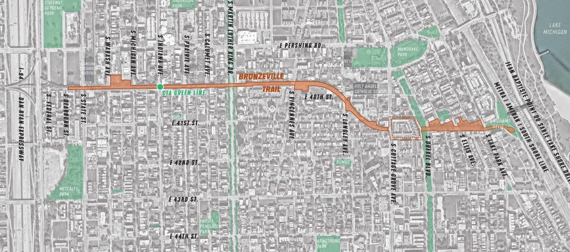
Bronzeville Trail proposal map. © BTTF, 2022. Accessed from Facebook (@Bronzeville Trail Task Force), December 08, 2025.